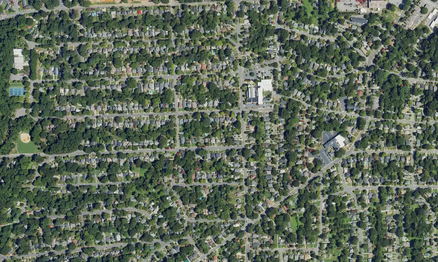
Ardmore, the city's first automobile suburb, is in ZIP code 27103, zoned for Reynolds High, with Miller Park; typical home value $279,442 in August 2026.
Last checked Oct. 12, 2026. Sources: the City of Winston-Salem’s Southwest Winston-Salem Area Plan, the city’s school zone and parks map layers, the N.C. State Historic Preservation Office, the N.C. Department of Public Instruction’s 2025-26 accountability data, WSTA’s published schedule data, OpenStreetMap and Zillow Research.
Ardmore is the large neighborhood of early 20th-century houses southwest of downtown, between Salem Parkway and Silas Creek Parkway. The city’s Southwest Winston-Salem Area Plan calls it “the city’s first automobile suburb,” with its oldest historic buildings dating from 1910, and its most significant historic resource. Ardmore was listed on the National Register of Historic Places in 2004. The neighborhood is in ZIP code 27103.
What this means for you
- Zoned high school: R.J. Reynolds High, 47.2% of state tests at grade level in 2025-26, according to the state’s accountability data. Confirm an address with the district at 336-727-2292.
- Home value: $279,442 in ZIP code 27103 in August 2026, according to the Zillow Home Value Index.
- Nearest freeway exit: Salem Parkway Exit 234C at Cloverdale Avenue, about 0.8 mile by road.
Part of our Winston-Salem neighborhoods guide.
Where it is
The Southwest plan area is bounded by Salem Parkway (the former Business 40) on the north, Peters Creek Parkway on the east and Silas Creek Parkway on the south and west. Ardmore lies inside it, with Hawthorne Road, Miller Street, Knollwood Street and Cloverdale Avenue among its main streets. The plan names the Ardmore Village Activity Center, about 5 acres on Hawthorne Road at Knollwood Street, with a grocery store, restaurants, a pharmacy and other shops.
The city’s hospital campus, which the plan calls Wake Forest Baptist Medical Center, sits on Ardmore’s northeast edge. Fire Station 6, which the plan calls the Ardmore Fire Station, serves the neighborhood and the city’s two hospitals. Ardmore is a National Register district, not a local historic district, so the Historic Resources Commission does not review changes to homes there; the county’s local districts are listed on the city’s historic districts page.
Schools
Ardmore is in Winston-Salem/Forsyth County Schools. We checked 115 evenly spaced points inside the National Register district on the city’s published school zone map layers:
- Elementary: 58 were zoned for Moore, 49 for Brunson and eight for Bolton.
- Middle: 113 were zoned for Wiley Magnet and two for Flat Rock.
- High: all 115 were zoned for R.J. Reynolds.
| Level | School | At grade level | Growth |
|---|---|---|---|
| Elementary | Moore Magnet Elementary, 451 Knollwood St. | 46.0% | Not met |
| Elementary | Brunson Elementary, 155 N. Hawthorne Road | 55.1% | Met |
| Elementary | Bolton Elementary, 1250 Bolton St. | 47.2% | Met |
| Middle | Wiley Magnet Middle, 1400 Northwest Blvd. | 44.9% | Not met |
| High | R.J. Reynolds High, 301 N. Hawthorne Road | 47.2% | Met |
Scores are the share of state tests at grade level or above in 2025-26 and the state’s growth rating. The district average was 52.4%. Because the elementary zones split the neighborhood, check each address with the district. More in our schools guide.
Home values
The Zillow Home Value Index is a modeled typical value for the middle third of homes, not a sale price. Zillow publishes no figure for Ardmore alone.
| Area | August 2026 | August 2025 | Change |
|---|---|---|---|
| ZIP code 27103 | $279,442 | $281,047 | -0.6% |
| City of Winston-Salem, for comparison | $263,057 | $262,613 | +0.2% |
ZIP code 27103 also takes in neighborhoods south and west of Ardmore. Trends are on our home prices page.
Parks and trails
The Southwest plan lists three parks in Ardmore; addresses are from the city’s parks map layer:
- Miller Park, 400 Leisure Lane, a 39-acre district park with picnic shelters.
- Ardmore Park, 1021 Melrose St., 4 acres with a soccer field, a softball field and four tennis courts.
- Lockland Park, 401 Lockland Ave., 2 acres with a playground.
The plan notes sidewalks around all three parks. The Twin City Trail runs near the neighborhood’s northern edge, as mapped on OpenStreetMap. More in our parks and trails guide.
Getting around
- Salem Parkway: Exit 234C at Cloverdale Avenue is about 0.8 mile by road from the middle of the neighborhood; Exit 234B at West First Street and Lockland Avenue about 1.1 miles; Exit 235 at US 158 and South Stratford Road about 1.3 miles.
- Downtown: about 2.8 miles by road to City Hall.
- Piedmont Triad International Airport: about 25.5 miles by road.
- Buses: WSTA routes 80, 83, 84, 95, 103 and 107 and the 120 WSTA-X West stop in or beside Ardmore, according to WSTA’s current schedule data. See wstransit.com.
Distances were measured with the OSRM routing engine on OpenStreetMap roads. They are distances, not drive times. More in our getting around guide.
Groceries and everyday stores
From OpenStreetMap:
- Supermarkets: Harris Teeter, 2281 Cloverdale Ave., about half a mile; Whole Foods Market, 41 Miller St.; Publix, 34 Miller St.; Trader Joe’s, 252 S. Stratford Road; Food Lion, South Hawthorne Road.
- Pharmacy: CVS Pharmacy, Cloverdale Avenue.
- Shopping centers: the Shoppes at Ardmore Village on Hawthorne Road.
How we built this page
The outline we used is the National Register district boundary published by the state historic preservation office; the history, parks and activity center come from the city’s Southwest area plan. School zones come from the city’s map layers, checked at evenly spaced points; confirm an address with the district. We found no public list of homeowners associations for Ardmore, so this page does not describe them. No freely licensed street-level photo of Ardmore was available that the site had not already used, so the picture is a federal aerial image of the neighborhood.
Frequently asked questions
What high school is Ardmore zoned for?
All 115 points we checked in the Ardmore historic district on the city’s school zone maps were zoned for R.J. Reynolds High. Elementary zones are split between Moore, Brunson and Bolton. Confirm an address with the district at 336-727-2292.
What ZIP code is Ardmore in Winston-Salem?
Ardmore is in ZIP code 27103. Zillow’s Home Value Index for 27103 was $279,442 in August 2026, down 0.6% from August 2025.
What parks are in Ardmore?
Miller Park, 400 Leisure Lane, 39 acres; Ardmore Park, 1021 Melrose St., 4 acres with ballfields and tennis courts; and Lockland Park, 401 Lockland Ave., with a playground.
Is Ardmore a historic district?
Ardmore was listed on the National Register of Historic Places in 2004, according to the city’s Southwest area plan. It is not one of the county’s local historic districts.
Have your say