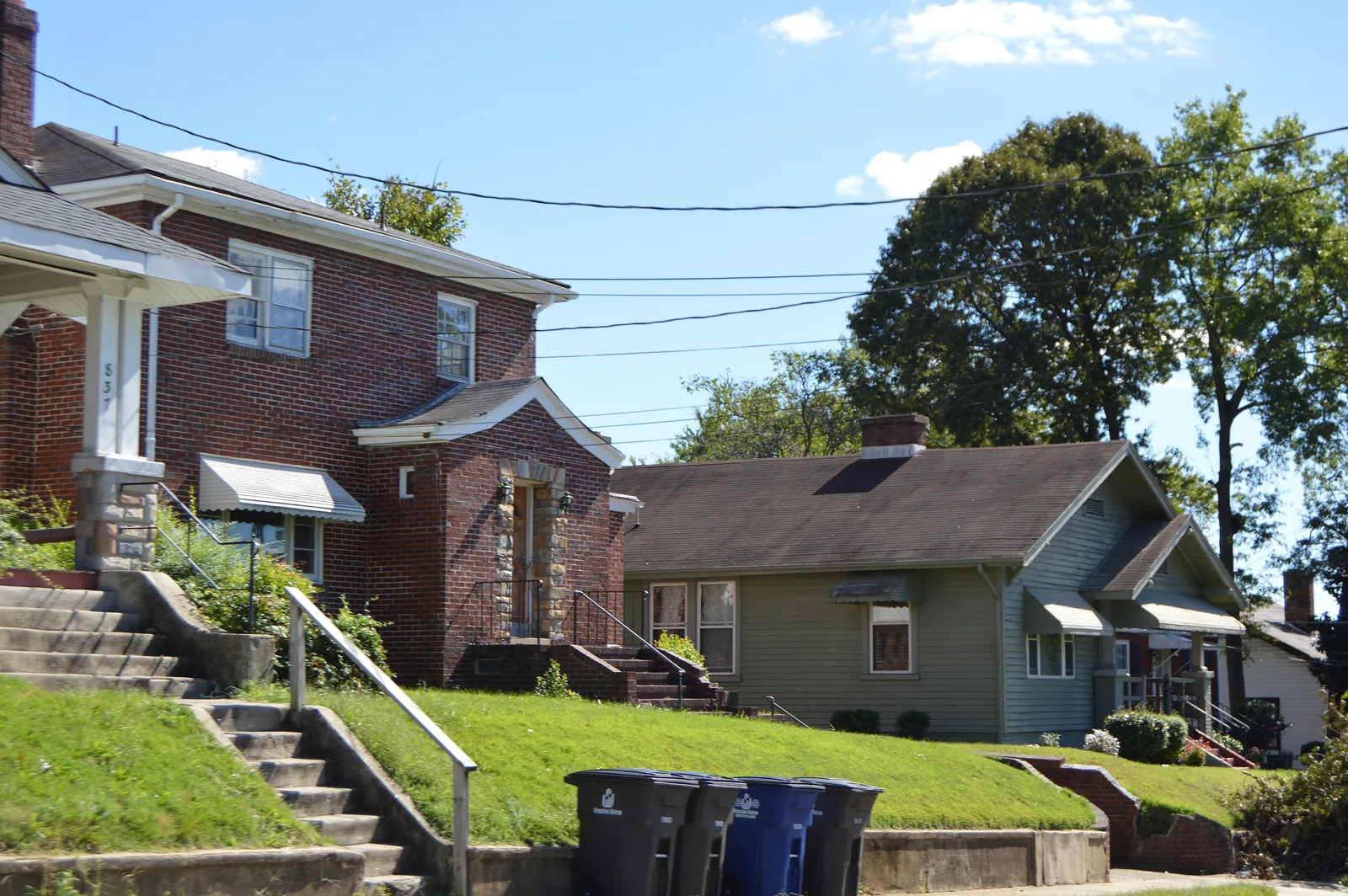
East Winston, east of US 52, is in ZIP code 27101 and mostly zoned for Petree Elementary and Carver High, with Union Station and Reynoldstown.
Last checked Oct. 12, 2026. Sources: the City of Winston-Salem’s East-Northeast Winston-Salem Area Plan, the city’s school zone and parks map layers, the N.C. State Historic Preservation Office, the N.C. Department of Public Instruction’s 2025-26 accountability data, WSTA’s published schedule data, OpenStreetMap and Zillow Research.
East Winston is the part of the city just east of US 52 and downtown, around Martin Luther King Jr. Drive, Fifth Street and Cleveland Avenue. The city’s East-Northeast Winston-Salem Area Plan says most of its planning area was built before 1940 as traditional urban neighborhoods, and that some of Winston-Salem’s first major housing developments were built there, including Reynoldstown (1917), Dreamland and City View (early 1920s). Homes are in ZIP code 27101.
What this means for you
- Zoned high school: Carver High for most of the area, 14.6% of state tests at grade level in 2025-26, according to the state’s accountability data. Confirm an address with the district at 336-727-2292.
- Home value: $226,961 in ZIP code 27101 in August 2026, according to the Zillow Home Value Index.
- Nearest freeway exit: Salem Parkway Exit 232A at Martin Luther King Jr. Drive, about 0.3 mile by road.
Part of our Winston-Salem neighborhoods guide.
Where it is
The East-Northeast planning area, about 4,523 acres, is bounded by Akron and Lansing drives on the north, Brushy Fork Branch, Winston Lake Park and US 158 on the east, the Norfolk Southern Railway on the south and US 52 on the west. All of it is inside the city. East Winston is its southwestern corner, next to downtown and Winston-Salem State University.
The plan names an East Winston Activity Center around the East Winston Shopping Center, and says the city proposes a transportation center in the restored Union Station at Martin Luther King Jr. Drive and Excelsior Street. Historic places include the Reynoldstown Historic District, listed on the National Register in 2008 for its 1920s to 1940s housing; Union Station; Mars Hill Baptist Church; and Goler Metropolitan AME Zion Church, according to the state historic preservation office.
Schools
East Winston is in Winston-Salem/Forsyth County Schools. We checked 48 evenly spaced points within about 0.7 mile of the spot OpenStreetMap marks as East Winston, against the city’s published school zone map layers:
- Elementary: 38 were zoned for Petree, six for Brunson, two for Diggs-Latham and one each for Forest Park and Ashley.
- Middle: 22 were zoned for East Forsyth Middle, 17 for Winston-Salem Preparatory Academy, six for Wiley and three for Hanes.
- High: 38 were zoned for Carver, six for R.J. Reynolds and four for Parkland.
| Level | School | At grade level | Growth |
|---|---|---|---|
| Elementary | Petree Elementary, 3815 Old Greensboro Road | 24.5% | Not met |
| Middle | East Forsyth Middle, 810 Bagley Drive, Kernersville | 33.1% | Not met |
| Middle | Winston-Salem Preparatory Academy, 1215 N. Cameron Ave. | 21.5% | Not met |
| High | Carver High, 3545 Carver School Road | 14.6% | Not met |
Scores are the share of state tests at grade level or above in 2025-26 and the state’s growth rating. Carver High’s four-year graduation rate was 69.6%. The district average on state tests was 52.4%. Zones change from block to block here, so check each address with the district. More in our schools guide.
Home values
The Zillow Home Value Index is a modeled typical value for the middle third of homes, not a sale price. Zillow publishes no figure for East Winston alone.
| Area | August 2026 | August 2025 | Change |
|---|---|---|---|
| ZIP code 27101 | $226,961 | $228,908 | -0.9% |
| City of Winston-Salem, for comparison | $263,057 | $262,613 | +0.2% |
ZIP code 27101 also covers downtown, the West End and Old Salem. Trends are on our home prices page.
Parks and trails
From the city’s parks map layer:
- Rupert Bell Park, 1501 Mt. Zion Place, 18 acres, with one of the city’s splash pads.
- Skyland Park, 1890 New Walkertown Road, 15 acres.
- Brushy Fork Park, 1860 E. First St.
- Fourteenth Street Park, 2020 E. Fourteenth St., and Harambee Park, 1400 E. Fourteenth St.
The Long Branch Trail, the Brushy Fork Greenway and the Newell/Massey Greenway run through or near the area, as mapped on OpenStreetMap. The Malloy-Jordan East Winston Heritage Center, a branch library, is at 1110 E. Seventh St. More in our parks and trails guide.
Getting around
- Salem Parkway: Exit 232A at Martin Luther King Jr. Drive is about 0.3 mile by road.
- US 52: Exit 109B to Salem Parkway is about 0.7 mile, and Exit 110B at Martin Luther King Jr. Drive about 0.8 mile.
- Downtown: about 1.1 miles by road to City Hall.
- Piedmont Triad International Airport: about 22.7 miles by road.
- Buses: WSTA routes 86, 87, 91, 92, 93, 94, 96, 98 and 105 stop in the area, according to WSTA’s current schedule data. See wstransit.com.
Distances were measured with the OSRM routing engine on OpenStreetMap roads. They are distances, not drive times. More in our getting around guide.
Groceries and everyday stores
From OpenStreetMap:
- Supermarkets: Compare Foods, North Cleveland Avenue; Food Lion, North Graham Avenue.
- Pharmacy: CVS Pharmacy, 589 N. Martin Luther King Jr. Drive.
How we built this page
The planning area, history and activity centers come from the city’s East-Northeast area plan; the historic listings come from the state historic preservation office. East Winston has no published boundary, so we used the area within about 0.7 mile of the place OpenStreetMap names East Winston. School zones come from the city’s map layers, checked at evenly spaced points; confirm an address with the district. We found no public list of homeowners associations for East Winston, so this page does not describe them.
Frequently asked questions
What schools serve East Winston?
Of 48 points we checked in East Winston on the city’s school zone maps, 38 were zoned for Petree Elementary and Carver High. Middle school zones split between East Forsyth Middle and Winston-Salem Preparatory Academy. Confirm an address with the district at 336-727-2292.
What ZIP code is East Winston?
East Winston is almost entirely in ZIP code 27101. Zillow’s Home Value Index for 27101 was $226,961 in August 2026.
Is there a library in East Winston?
Yes. The Malloy-Jordan East Winston Heritage Center, a branch library, is at East Seventh Street and Cleveland Avenue, according to the city’s East-Northeast area plan.
How far is East Winston from downtown?
About 1.1 miles by road from the middle of East Winston to City Hall. Salem Parkway Exit 232A at Martin Luther King Jr. Drive is about 0.3 mile away.
Have your say