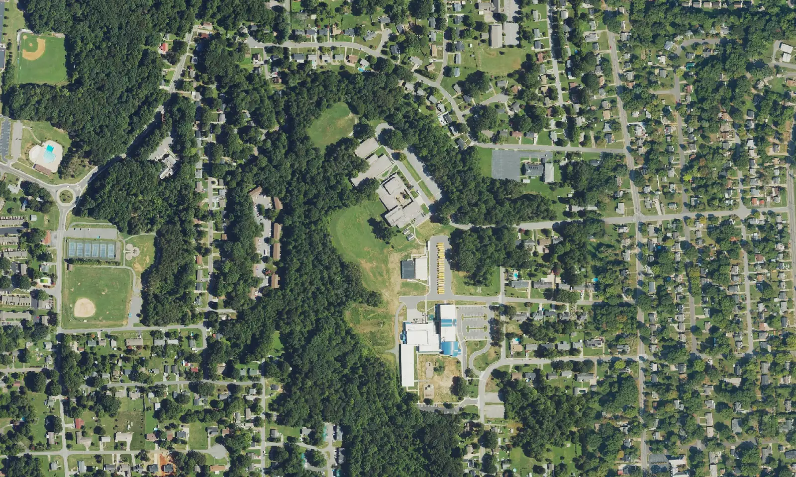
Konnoak Hills, south of I-40, is in ZIP code 27127 and zoned for Konnoak Elementary, Konnoak Middle and Parkland High, about 1.1 miles from US 52 Exit 105.
Last checked Oct. 12, 2026. Sources: the City of Winston-Salem’s South Suburban Area Plan, the city’s school zone and parks map layers, the N.C. Department of Public Instruction’s 2025-26 accountability data, WSTA’s published schedule data, OpenStreetMap and Zillow Research.
Konnoak Hills is the residential area along Konnoak Drive on the south side of Winston-Salem, just south of Interstate 40 and west of US 52. The city’s South Suburban Area Plan names it among the neighborhoods in the northern part of its planning area and says they “lost much of their connectivity and interaction with the Washington Park and Waughtown neighborhoods due to construction of I-40 in the 1980s.” Homes are in ZIP code 27127.
What this means for you
- Zoned high school: Parkland High, 25.5% of state tests at grade level in 2025-26, according to the state’s accountability data. Confirm an address with the district at 336-727-2292.
- Home value: $257,595 in ZIP code 27127 in August 2026, according to the Zillow Home Value Index.
- Nearest freeway exit: US 52 Exit 105 at Clemmonsville Road, about 1.1 miles by road.
Part of our Winston-Salem neighborhoods guide.
Where it is
The South Suburban planning area is bounded by I-40 and Silas Creek Parkway on the north, Ebert Road on the west, the Davidson County line on the south and NC 109 and Old Thomasville Road on the east. About 73% of it is inside the city. Konnoak Hills is at its northern edge, between Peters Creek Parkway and South Main Street, with Clemmonsville Road as its main east-west road.
The plan notes sidewalks along Konnoak Drive and other subdivision streets, and lists Konnoak Elementary, Parkland High and Forsyth Technical Community College among the schools in the planning area. OpenStreetMap also names Konnoak Village, a neighborhood at the south end of Konnoak Drive.
Schools
Konnoak Hills is in Winston-Salem/Forsyth County Schools. We checked 47 evenly spaced points within about 0.6 mile of Konnoak Drive and Konnoak Elementary against the city’s published school zone map layers:
- Elementary: 46 were zoned for Konnoak and one for Griffith.
- Middle: 46 were zoned for Konnoak Middle and one for Flat Rock. The city’s map labels this zone Philo-Hill; the state’s 2025-26 data and the district use the name Konnoak Middle School.
- High: all 47 were zoned for Parkland.
| Level | School | At grade level | Growth |
|---|---|---|---|
| Elementary | Konnoak Elementary, 3200 Renon Road | 45.5% | Exceeded |
| Middle | Konnoak Middle | 24.0% | Not met |
| High | Parkland High, 1600 Brewer Road | 25.5% | Met |
Scores are the share of state tests at grade level or above in 2025-26 and the state’s growth rating. Parkland High’s four-year graduation rate was 79.8%. The district average on state tests was 52.4%. More in our schools guide.
Home values
The Zillow Home Value Index is a modeled typical value for the middle third of homes, not a sale price. Zillow publishes no figure for Konnoak Hills alone.
| Area | August 2026 | August 2025 | Change |
|---|---|---|---|
| ZIP code 27127 | $257,595 | $256,801 | +0.3% |
| City of Winston-Salem, for comparison | $263,057 | $262,613 | +0.2% |
ZIP code 27127 also covers Washington Park and a large area of the south side. Trends are on our home prices page.
Parks and trails
From the city’s parks map layer:
- Parkland Park, 1660 Brewer Road, a 24-acre community park next to Parkland High.
- South Park, 190 W. Lemly St., a 5-acre neighborhood park.
The Southside Branch Library, 3185 Buchanan St., is about 0.4 mile from Konnoak Elementary; the South Suburban plan calls it the only library in its planning area. Washington Park and the Salem Creek Greenway are about 1.5 miles north, across I-40. More in our parks and trails guide.
Getting around
- US 52: Exit 105 at Clemmonsville Road is about 1.1 miles by road.
- I-40: Exit 193C at Silas Creek Parkway and South Main Street is about 1.6 miles.
- Downtown: about 3.6 miles by road to City Hall.
- Piedmont Triad International Airport: about 24.5 miles by road.
- Buses: the 121 WSTA-X South stops in the area, according to WSTA’s current schedule data. See wstransit.com.
Distances were measured with the OSRM routing engine on OpenStreetMap roads. They are distances, not drive times. More in our getting around guide.
Groceries and everyday stores
From OpenStreetMap:
- Supermarkets: Aldi, 2715 Peters Creek Parkway, about 0.7 mile; Food Lion, Peach Avenue; Compare Foods, Salisbury Ridge Road.
- Shopping centers: the Shops at South Main, Brewer Crossing and Parkway Plaza, all within about a mile.
How we built this page
Konnoak Hills has no published boundary, so we used the area within about 0.6 mile of Konnoak Drive and Konnoak Elementary, the streets and school the South Suburban plan names; the plan supplied the history and roads. School zones come from the city’s map layers, checked at evenly spaced points; confirm an address with the district. We found no public list of homeowners associations for Konnoak Hills, so this page does not describe them. No freely licensed street-level photo of the area was available, so the picture is a federal aerial image of it.
Frequently asked questions
What schools serve Konnoak Hills?
Of 47 points we checked around Konnoak Hills on the city’s school zone maps, 46 were zoned for Konnoak Elementary and Konnoak Middle, and all 47 for Parkland High. Confirm an address with the district at 336-727-2292.
What ZIP code is Konnoak Hills?
Konnoak Hills is in ZIP code 27127. Zillow’s Home Value Index for 27127 was $257,595 in August 2026, up 0.3% from August 2025.
Is there a library near Konnoak Hills?
Yes. The Southside Branch Library is on Buchanan Street, the only library in the city’s South Suburban planning area, according to the area plan.
How far is Konnoak Hills from downtown Winston-Salem?
About 3.6 miles by road to City Hall. US 52 Exit 105 at Clemmonsville Road is about 1.1 miles away.
Have your say