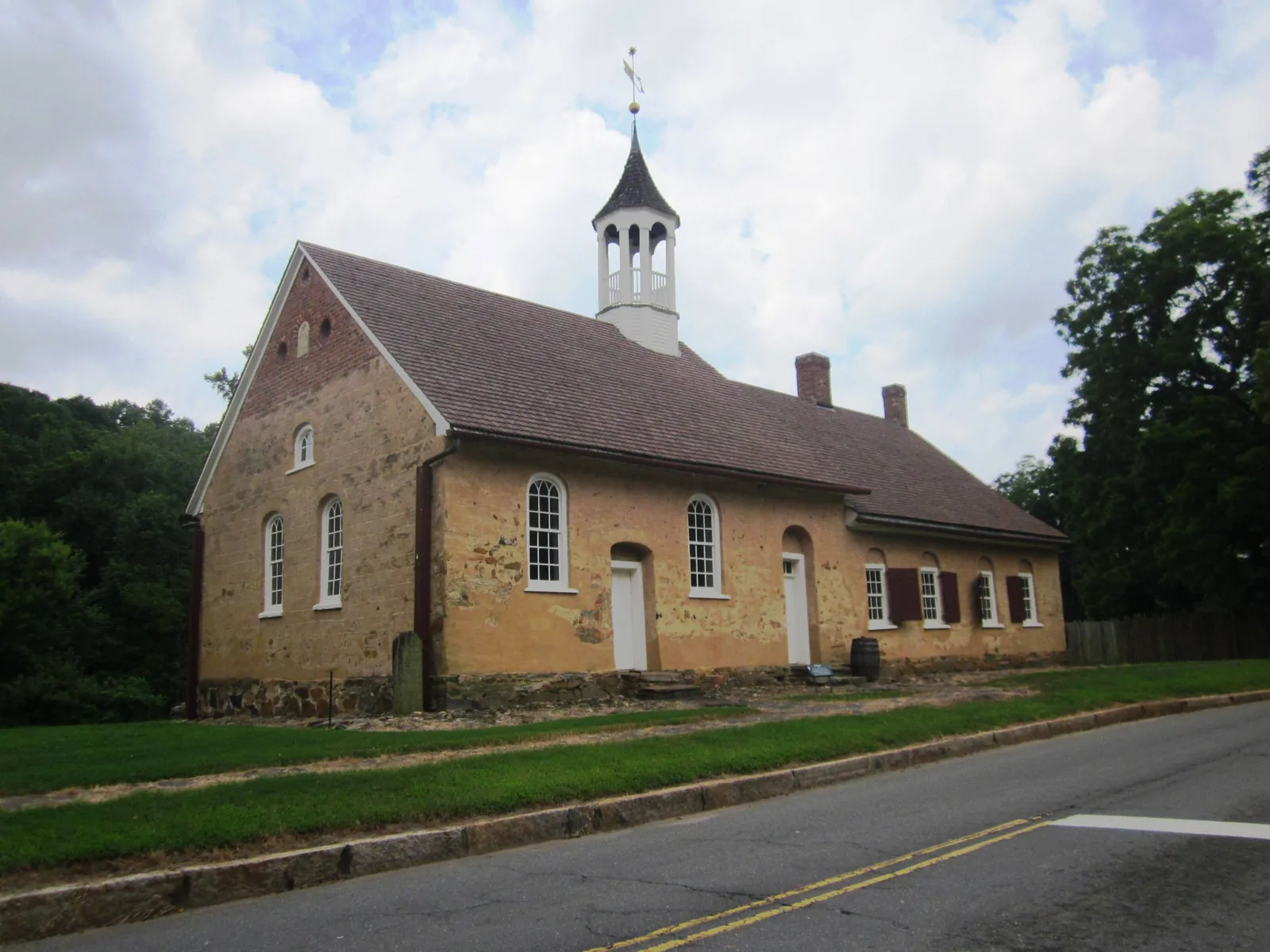
Old Town, along Reynolda Road by Historic Bethabara Park, is in ZIP code 27106, with high school zones split among North Forsyth, Mount Tabor and Reagan.
Last checked Oct. 12, 2026. Sources: the City of Winston-Salem’s North Suburban Area Plan and West Suburban Area Plan, the city’s Historic Bethabara Park page, school zone and parks map layers, the N.C. Department of Public Instruction’s 2025-26 accountability data, WSTA’s published schedule data, OpenStreetMap and Zillow Research.
Old Town is the suburban area in northwest Winston-Salem along Reynolda Road, from Old Town Elementary and Old Town Park east to Historic Bethabara Park. OpenStreetMap marks two places with the name: Old Town, by Old Town Elementary on Reynolda Road, and Oldtown, at the old Moravian settlement of Bethabara, where Old Town Road and Old Town Drive run. Reynolda Road is the line between the city’s North Suburban and West Suburban planning areas, so Old Town falls in both. All the homes we checked are in ZIP code 27106.
What this means for you
- Zoned high school: split among North Forsyth High (30.2% of state tests at grade level in 2025-26), Mount Tabor High (45.2%) and Reagan High (77.1%), according to the state’s accountability data. Confirm an address with the district at 336-727-2292.
- Home value: $333,936 in ZIP code 27106 in August 2026, according to the Zillow Home Value Index.
- Nearest freeway exit: US 52 Exit 116 at Hanes Mill Road, about 3.5 miles by road.
Part of our Winston-Salem neighborhoods guide.
Where it is
Bethabara, founded in 1753 by German-speaking Moravians, was the first European settlement in the North Carolina Piedmont, according to the city’s Historic Bethabara Park page, which describes the park as a National Historic Landmark. The North Suburban Area Plan, which covers the land east of Reynolda Road, lists Old Town Drive, Oldtown Road and Bethabara Road among streets with sidewalks, and Bethabara Park Boulevard as one of its main boulevards. The West Suburban Area Plan, for the land west of Reynolda Road, lists Old Town Elementary and Old Town Park.
The North Suburban plan names Fire Station 8 on Reynolda Road and Fire Station 14 on Shattalon Drive. The Old Town Club golf course, about 3.5 miles southeast near Reynolda Village, shares the name but is not part of this area.
Schools
Old Town is in Winston-Salem/Forsyth County Schools. We checked 48 evenly spaced points within about 1.15 miles of a point on Reynolda Road between Old Town Elementary and Bethabara, against the city’s published school zone map layers:
- Elementary: 30 were zoned for Old Town, 11 for Speas and seven for Jefferson.
- Middle: 27 were zoned for Mineral Springs, 11 for Paisley, seven for Jefferson and three for Northwest.
- High: 23 were zoned for North Forsyth, 17 for Mount Tabor and eight for Reagan.
| Level | School | At grade level | Growth |
|---|---|---|---|
| Elementary | Old Town Elementary, 3930 Reynolda Road | 37.0% | Met |
| Elementary | Speas Elementary, 2000 W. Polo Road | 57.1% | Not met |
| Middle | Mineral Springs Middle, 4559 Ogburn Ave. | 23.7% | Not met |
| Middle | Paisley Magnet, 1394 Thurmond St. | 34.6% | Not met |
| High | North Forsyth High, 5705 Shattalon Drive | 30.2% | Met |
| High | Mount Tabor High, 342 Petree Road | 45.2% | Not met |
| High | Reagan High, 3750 Transou Road, Pfafftown | 77.1% | Exceeded |
Scores are the share of state tests at grade level or above in 2025-26 and the state’s growth rating. Four-year graduation rates were 81% at North Forsyth, 87.8% at Mount Tabor and 93.7% at Reagan. The district average on state tests was 52.4%. Because the zones split the area, check each address with the district. More in our schools guide.
Home values
The Zillow Home Value Index is a modeled typical value for the middle third of homes, not a sale price. Zillow publishes no figure for Old Town alone.
| Area | August 2026 | August 2025 | Change |
|---|---|---|---|
| ZIP code 27106 | $333,936 | $334,148 | -0.1% |
| City of Winston-Salem, for comparison | $263,057 | $262,613 | +0.2% |
ZIP code 27106 covers a large part of northwest Winston-Salem. Trends are on our home prices page.
Parks and trails
From the city’s parks map layer and park pages:
- Historic Bethabara Park, 2147 Bethabara Road, 183 acres with historic buildings, walking and birding trails and wetlands; free, dawn to dusk; visitor center 336-924-8191.
- Bethabara Park, 4451 Old Town Drive, a 30-acre community park.
- Old Town Park, 4550 Shattalon Drive, 16 acres with a recreation center, playground, picnic shelter, softball field, tennis court and fitness course, according to the West Suburban plan.
- Nelson L. Malloy Jr. Park, 2615 Bethabara Road, with a splash pad.
The 2.7-mile Bethabara Trail runs from Reynolda Commons Shopping Center through Historic Bethabara, according to the North Suburban plan; the city’s Bethabara Greenway page has the map. More in our parks and trails guide.
Getting around
- US 52: Exit 116 at Hanes Mill Road is about 3.5 miles by road; Exit 115 at University Parkway about 3.6 miles.
- Downtown: about 7 miles by road to City Hall.
- Piedmont Triad International Airport: about 30.2 miles by road.
- Buses: WSTA Route 97 (Hanes Mill circulator via Bethabara Park, Reynolda Road and Shattalon Drive) and the 120 WSTA-X West serve the area, according to WSTA’s current schedule data. See wstransit.com.
Distances were measured with the OSRM routing engine on OpenStreetMap roads. They are distances, not drive times. More in our getting around guide.
Groceries and everyday stores
From OpenStreetMap:
- Supermarkets: Food Lion, 3800 Reynolda Road, about half a mile; Harris Teeter, 2835 Reynolda Road, and Lidl, 2445 Fairlawn Drive, about 1.5 miles south.
- Library: Reynolda Manor Branch Library, 2839 Fairlawn Drive, by the Reynolda Manor shopping center.
How we built this page
Old Town has no published boundary, so we used the area within about 1.15 miles of a point on Reynolda Road between the two places OpenStreetMap names Old Town and Oldtown; the plans supplied the streets, parks and facilities. School zones come from the city’s map layers, checked at evenly spaced points; confirm an address with the district. We found no public list of homeowners associations for Old Town, so this page does not describe them.
Frequently asked questions
What schools serve Old Town in Winston-Salem?
Of 48 points we checked around Old Town on the city’s school zone maps, 30 were zoned for Old Town Elementary. High school zones split: 23 for North Forsyth, 17 for Mount Tabor and eight for Reagan. Confirm an address with the district at 336-727-2292.
What ZIP code is Old Town?
All the points we checked in Old Town were in ZIP code 27106. Zillow’s Home Value Index for 27106 was $333,936 in August 2026, down 0.1% from August 2025.
What is Historic Bethabara Park?
A 183-acre city park at 2147 Bethabara Road on the site of the first European settlement in the North Carolina Piedmont, founded by Moravians in 1753. The grounds are free and open dawn to dusk; visitor center 336-924-8191.
How far is Old Town from downtown Winston-Salem?
About 7 miles by road to City Hall. The nearest freeway exits are on US 52 at Hanes Mill Road (Exit 116) and University Parkway (Exit 115), about 3.5 miles away.
Have your say