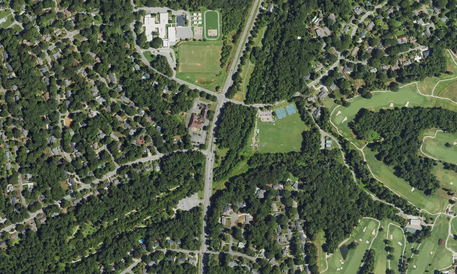
Sherwood Forest, around Yorkshire Road in west Winston-Salem, spans ZIP codes 27106 and 27104, split between Mount Tabor and Reynolds high schools.
Last checked Oct. 12, 2026. Sources: the City of Winston-Salem’s West Suburban Area Plan and Northwest Area Plan, the city’s school zone and parks map layers, the N.C. Department of Public Instruction’s 2025-26 accountability data, WSTA’s published schedule data, OpenStreetMap and Zillow Research.
Sherwood Forest is the suburban area on Winston-Salem’s west side around Yorkshire Road, Sherwood Forest Road and Sherwood Forest Elementary, between Robinhood Road and Country Club Road. The city’s West Suburban Area Plan names the Sherwood Forest Activity Center at Robinhood Road and North Peace Haven Road as one of its commercial centers, and Sherwood Forest Elementary as one of the planning area’s schools. Homes are split between ZIP codes 27106 and 27104.
What this means for you
- Zoned high school: split. Most of the area is zoned for Mount Tabor High, 45.2% of state tests at grade level in 2025-26; the eastern and southern part for R.J. Reynolds High, 47.2%, according to the state’s accountability data. Confirm an address with the district at 336-727-2292.
- Home value: $333,936 in ZIP code 27106 and $372,421 in 27104 in August 2026, according to the Zillow Home Value Index.
- Nearest freeway exit: Salem Parkway Exit 237 at Silas Creek Parkway, about 1.7 miles by road.
Part of our Winston-Salem neighborhoods guide.
Where it is
The West Suburban planning area is bounded by Reynolda Road on the north, Silas Creek Parkway on the east, US 421 on the south and the Lewisville town limits on the west; about 73% of it is inside the city. The plan lists Sherwood Forest among seven activity centers there, with Robinhood Village, Gordon Manor, Harper Hill Commons and others.
Several streets carry Robin Hood names. The city’s Northwest Area Plan routes its Yadkin County Connector bike route along Yorkshire, Doncaster, Archer, Kirklees, Friar Tuck and Will Scarlet roads. The West Suburban plan also mentions a New Sherwood Forest neighborhood farther west, linked to the Muddy Creek Greenway by the half-mile Cedar Trails Connector.
Schools
Sherwood Forest is in Winston-Salem/Forsyth County Schools. We checked 47 evenly spaced points within about 0.6 mile of Sherwood Forest Elementary against the city’s published school zone map layers:
- Elementary: 26 were zoned for Sherwood Forest, 19 for Whitaker and one each for South Fork and Jefferson.
- Middle: 28 were zoned for Jefferson and 19 for Wiley Magnet.
- High: 28 were zoned for Mount Tabor and 19 for R.J. Reynolds.
| Level | School | At grade level | Growth |
|---|---|---|---|
| Elementary | Sherwood Forest Elementary, 1055 Yorkshire Road | 86.2% | Met |
| Elementary | Whitaker Elementary, 2600 Buena Vista Road | 78.2% | Exceeded |
| Middle | Jefferson Middle, 3500 Sally Kirk Road | 72.0% | Not met |
| Middle | Wiley Magnet Middle, 1400 Northwest Blvd. | 44.9% | Not met |
| High | Mount Tabor High, 342 Petree Road | 45.2% | Not met |
| High | R.J. Reynolds High, 301 N. Hawthorne Road | 47.2% | Met |
Scores are the share of state tests at grade level or above in 2025-26 and the state’s growth rating. Mount Tabor’s four-year graduation rate was 87.8% and Reynolds’ 82.8%. The district average on state tests was 52.4%. Because the zones split this area, check each address with the district. More in our schools guide.
Home values
The Zillow Home Value Index is a modeled typical value for the middle third of homes, not a sale price. Zillow publishes no figure for Sherwood Forest alone.
| Area | August 2026 | August 2025 | Change |
|---|---|---|---|
| ZIP code 27106 | $333,936 | $334,148 | -0.1% |
| ZIP code 27104 | $372,421 | $370,550 | +0.5% |
| City of Winston-Salem, for comparison | $263,057 | $262,613 | +0.2% |
Of the points we checked, 27 were in 27106 and 20 in 27104. Trends are on our home prices page.
Parks and trails
- Shaffner Park, 900 Yorkshire Road, a 56-acre community park, according to the city’s parks map layer.
- The Muddy Creek Greenway, 2.91 miles from Jefferson Elementary to Country Club Road according to the West Suburban plan, runs to the west.
- The Silas Creek Greenway runs to the east.
More in our parks and trails guide.
Getting around
- Salem Parkway: Exit 237 at Silas Creek Parkway is about 1.7 to 2.2 miles by road, depending on direction; Exit 236 at Knollwood Street about 2.4 miles.
- Downtown: about 6.2 miles by road to City Hall.
- Piedmont Triad International Airport: about 28.9 miles by road.
- Buses: WSTA Route 95 (Peace Haven, Country Club, Vinegar Hill) serves the area, according to WSTA’s current schedule data. See wstransit.com.
Distances were measured with the OSRM routing engine on OpenStreetMap roads from Sherwood Forest Elementary’s neighborhood. They are distances, not drive times. More in our getting around guide.
Groceries and everyday stores
The West Suburban plan says the Sherwood Forest activity center “alone has three grocery stores.” OpenStreetMap lists, about 0.7 to 1 mile north:
- Supermarkets: Lowes Foods, 3372 Robinhood Road; The Fresh Market, 3285 Robinhood Road; Harris Teeter, 1955 Peace Haven Road.
- Pharmacies: CVS Pharmacy, 3325 Robinhood Road; Robinhood Family Pharmacy, 3424 Robinhood Road; Walgreens, 3488 Robinhood Road.
How we built this page
Sherwood Forest has no published boundary, so we used the area within about 0.6 mile of Sherwood Forest Elementary on Yorkshire Road; the activity center and greenway details come from the West Suburban plan. School zones come from the city’s map layers, checked at evenly spaced points; confirm an address with the district. We found no public list of homeowners associations for Sherwood Forest, so this page does not describe them. No freely licensed street-level photo of the area was available, so the picture is a federal aerial image of it.
Frequently asked questions
What schools serve Sherwood Forest in Winston-Salem?
The area is split. Of 47 points we checked on the city’s school zone maps, 28 were zoned for Jefferson Middle and Mount Tabor High and 19 for Wiley Magnet Middle and R.J. Reynolds High; 26 were zoned for Sherwood Forest Elementary and 19 for Whitaker Elementary. Confirm an address with the district at 336-727-2292.
What ZIP code is Sherwood Forest?
Sherwood Forest spans ZIP codes 27106 and 27104. In August 2026 Zillow’s Home Value Index was $333,936 in 27106 and $372,421 in 27104.
Where do people in Sherwood Forest shop for groceries?
The city’s West Suburban area plan names the Sherwood Forest activity center at Robinhood Road and North Peace Haven Road, with three grocery stores. OpenStreetMap lists Lowes Foods and The Fresh Market on Robinhood Road and Harris Teeter on Peace Haven Road.
What park is in Sherwood Forest?
Shaffner Park, 900 Yorkshire Road, a 56-acre community park, according to the city’s parks map.
Have your say