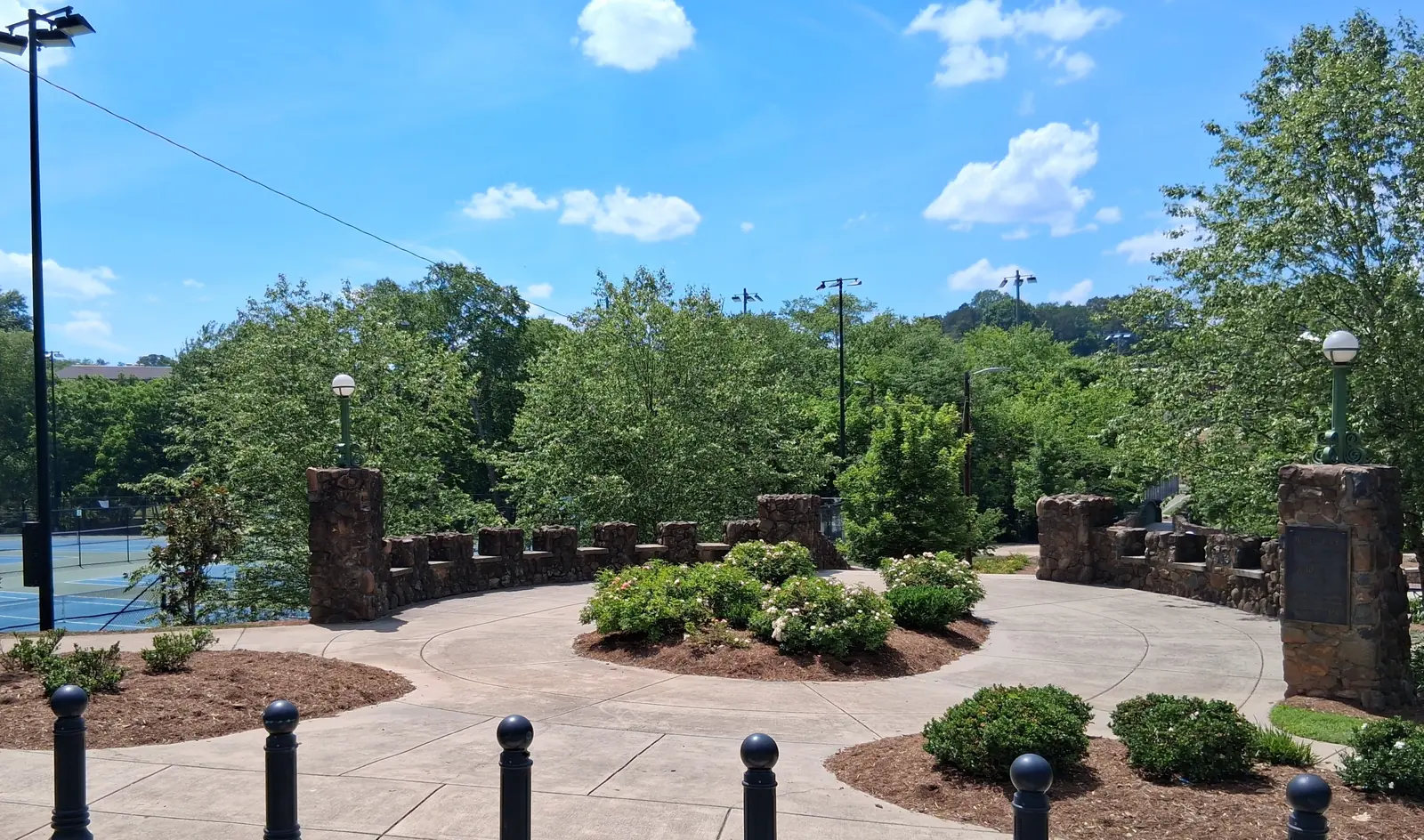
The West End is a historic district next to downtown in ZIP code 27101, zoned for Brunson Elementary, Wiley Middle and Reynolds High, with Hanes Park.
Last checked Oct. 12, 2026. Sources: the City of Winston-Salem’s local historic districts page and West End Historic Overlay District Report, the city’s school zone and parks map layers, the N.C. Department of Public Instruction’s 2025-26 accountability data, WSTA’s published schedule data, OpenStreetMap and Zillow Research.
The West End is the hillside neighborhood on the western edge of downtown, laid out in 1890 by the West End Hotel and Land Company to a plan by Jacob Lott Ludlow, according to the city’s West End Historic Overlay District Report. The report calls it “one of the most fully-realized and intact examples of a turn-of-the-century streetcar suburb in North Carolina,” with curving streets, terraced lawns and stone retaining walls, and houses built between 1887 and 1930. The district is in ZIP code 27101.
What this means for you
- Zoned high school: R.J. Reynolds High, 47.2% of state tests at grade level in 2025-26, according to the state’s accountability data. Confirm an address with the district at 336-727-2292.
- Home value: $226,961 in ZIP code 27101 in August 2026, according to the Zillow Home Value Index.
- Nearest freeway exit: Salem Parkway Exit 234B at West First Street, about 0.5 mile by road.
Part of our Winston-Salem neighborhoods guide.
Where it is
The report describes a “crescent-shaped district” bounded roughly by West End Boulevard on the northeast and north, Peters Creek through Hanes Park on the northwest and west, Sunset Drive on the west and southwest, West End Boulevard and the old I-40, now Salem Parkway, on the south, and West Fourth Street on the southeast and east, curving back by Fifth, Broad and Sixth streets. The historic overlay district’s boundaries match the National Register district, listed in 1986.
Because it is a local historic overlay district, the Forsyth County Historic Resources Commission reviews exterior changes, additions and new construction through a certificate of appropriateness, according to the city’s local historic districts page, which links the district map and design review standards. The report notes that the district also has some commercial buildings and churches among its houses.
Schools
The West End is in Winston-Salem/Forsyth County Schools. All 40 evenly spaced points we checked inside the historic district on the city’s published school zone map layers were zoned for the same three schools. Scores are the share of state tests at grade level or above in 2025-26 and the state’s growth rating.
| Level | School | At grade level | Growth |
|---|---|---|---|
| Elementary | Brunson Elementary, 155 N. Hawthorne Road | 55.1% | Met |
| Middle | Wiley Magnet Middle, 1400 Northwest Blvd. | 44.9% | Not met |
| High | R.J. Reynolds High, 301 N. Hawthorne Road | 47.2% | Met |
R.J. Reynolds High had a four-year graduation rate of 82.8%. The district average on state tests was 52.4%. More in our schools guide.
Home values
Zillow publishes no figure for the West End alone. The Zillow Home Value Index is a modeled typical value for the middle third of homes, not a sale price.
| Area | August 2026 | August 2025 | Change |
|---|---|---|---|
| ZIP code 27101 | $226,961 | $228,908 | -0.9% |
| City of Winston-Salem, for comparison | $263,057 | $262,613 | +0.2% |
ZIP code 27101 also covers downtown and East Winston, so it is a broad measure. Trends are on our home prices page.
Parks and trails
From the city’s parks map layer:
- Hanes Park, 1406 Northwest Blvd., a 35-acre district park along Peters Creek with a tennis center, track and fields, according to the city’s South Central area plan.
- Grace Court, 931 W. Fourth St., a small park that was part of Ludlow’s 1890 plan and was given to the city in 1905, according to the West End report.
- Spring Park, 650 N. Broad St., and Second Street Park, 649 W. Second St.
The Twin City Trail runs along the district’s edge, as mapped on OpenStreetMap. The Forsyth County Central Library, 660 W. Fifth St., is about 0.4 mile away. More in our parks and trails guide.
Getting around
- Salem Parkway: Exit 234B at West First Street and Lockland Avenue is about 0.5 mile by road; Exit 234C at Cloverdale Avenue about 0.7 mile; Exit 234A at Peters Creek Parkway about 0.8 mile.
- Downtown: about 1.2 miles by road to City Hall.
- Piedmont Triad International Airport: about 24.4 miles by road.
- Buses: WSTA routes 80, 83, 84, 85, 90, 95, 103 and 107 and the 120 WSTA-X West stop in or beside the district, according to WSTA’s current schedule data. See wstransit.com.
Distances were measured with the OSRM routing engine on OpenStreetMap roads. They are distances, not drive times. More in our getting around guide.
Groceries and everyday stores
There is no supermarket inside the district. OpenStreetMap lists these about a mile away:
- Supermarkets: Whole Foods Market, 41 Miller St.; Publix, 34 Miller St.; Harris Teeter, 2281 Cloverdale Ave.; Guru Market, 635 Peters Creek Parkway.
- Pharmacy: CVS Pharmacy, Cloverdale Avenue.
How we built this page
The boundaries, history and review rules come from the city’s West End report and historic districts page; the outline we used is the National Register district boundary published by the N.C. State Historic Preservation Office. School zones come from the city’s map layers, checked at evenly spaced points; confirm an address with the district at 336-727-2292. We found no public list of homeowners associations for the West End, so this page does not describe them.
Frequently asked questions
What schools serve the West End in Winston-Salem?
All 40 points we checked inside the West End historic district on the city’s school zone maps were zoned for Brunson Elementary, Wiley Magnet Middle and R.J. Reynolds High. Confirm an address with the district at 336-727-2292.
Is the West End a historic district?
Yes. It was listed on the National Register of Historic Places in 1986 and is also a local historic overlay district, so the Forsyth County Historic Resources Commission reviews exterior changes to properties there.
What is the typical home value in the West End?
Zillow publishes no figure for the West End alone. Its Home Value Index for ZIP code 27101, which includes the West End, was $226,961 in August 2026.
What park is in the West End?
Hanes Park, a 35-acre city park at 1406 Northwest Blvd., sits on the district’s northwest side along Peters Creek.
Have your say